The Pamela project image gallery


This pages provides some images from the Pamela SAR image handling system.

Most of these are posters made with Pamela software (that were displayed at the European SAR conference in Ulm 2004, or in Dresden 2006)


These images are property of ONERA, with CNES, DLR and IGN proprietary parts, only private and non commercial use is allowed (contact ONERA marketing department for any other use)

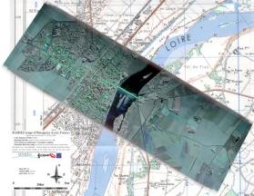
A nice polarimetric SAR image of the town of Beaugency sur Loire at the 3 cm wavelength (8.6Mb)
download poster_Beaugency.jpg (if this fails try this link)

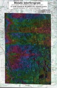
An interferometric bi-static SAR image of the vicinity of Nīmes airport at the 3 cm wavelength. This images is obtained with two radar systems : the E-SAR (DLR airborne SAR) is transmitting while the RAMSES (ONERA airborne SAR) is receiving with two separated antennae. Interference pattern between the two antennae provide clue on the landscape features elevation. This image is to my knowledge the first of its kind ever obtained. Map background have been scanned from an used folded paper map, hence there are some mismatches between the A4 scanner "tiles". (4.8Mb)
download poster_IF_bistatique.jpg (if this fails try this link)

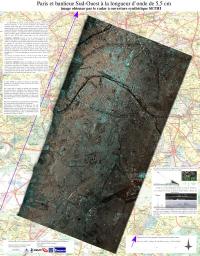
A wide coverage polarimetric SAR image of Paris and its south suburban area at the 5.5 cm wavelength. This is an old image, for which accurate trajectory measurement is not available, hence the image to map registration is lost. Poster legends are in French, I shall translate it... promised! It explains the basics of SAR, and shows a vertical sounding image obtained while the plane overflown the skyscrapers of the town of "La Defense". (on the top left corner of the poster) (5.4Mb)
download poster_Paris.jpg (if this fails try this link)

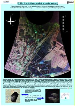
The first SAR image along a circular trajectory acquired at ONERA. This is a P-band polarimetric image on St-Gilles in Camargue in the South of France. Small images of the first full circles acquired a week later in Sweden -over the Kvarn test-range facility- are also presented (1.7Mb).
download poster_St-Gilles-en-Camargue.jpg (if this fails try this link)

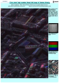
An high resolution colour SAR image (X-band) obtained on the town of Toulouse (South West of France). There is a little explanation of the colour radar imaging and an optical image for comparison (5.1Mb).
download poster_Toulouse.jpg (if this fails try this link)

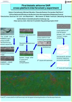
An interferometric bi-static cross-platform SAR image of the vicinity of Nīmes airport at the 3 cm wavelength. This images is obtained with two radar systems : the E-SAR (DLR airborne SAR) is transmitting and receiving while the RAMSES (ONERA airborne SAR) is receiving. Interference pattern between the two antennae of both aircrafts provide clue on the landscape features elevation. This image is to my knowledge the first of its kind ever obtained. It is much more difficult to compute than the above bistatic interferogram. Main steps of the computations are illustrated (1Mb).
download poster_bistatic_crossplatform_IF.jpg (if this fails try this link)

An old poster presenting the SAR image distorsion model of the pamelaX11 SAR data handling system. With a screenshot of the software in action over the Artenay sugar factory in the centre France (306Kb).
download ceos99.jpg (if this fails try this link)

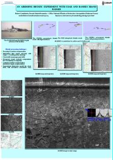
A poster describing the DLR-ONERA bistatic experiment over Nimes (South of France) with a bistatic view with 45° depression angle illuminating and 15° (grazing) depression angle receiving. Details under different bistatic angle are also given (338Kb).
download tiwrs03_biram.jpg (if this fails try this link)

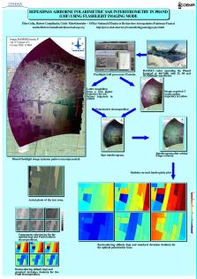
A poster about the first polarimetric repeat-pass interferometry performed on opportunistic data: A recording tape broke leaving only 15 seconds of signal on one aquisition. The acquisition was performed another time, but due to shift in flightlevels due to meteorological change, the separation in altitude allowed for interferometric measurements. We used flashlight image geometry in place of the more common stripmap geometry in order to maximise the ground coverage of the first image (overwise the 15s signal would have give a very narrow image because it is only marginally longer than the integration time). Imaged area is centered on the Nezer forest in the West of France, but extends up to the Arcachon bassin at the top of the image (273Kb).
download tiwrs03_ifpol.jpg (if this fails try this link)

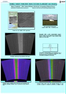
A poster about an alternative to the classical space-time adaptive processing (STAP) used for moving target detection with side-looking radar. This type of radar has several along-track separated antennae for discriminating Doppler effect due to azimut angle from Doppler effect due to proper motion. Here, we use focused SAR images (in the flashlight geometry) and compare the images obtained from each channel to detect and localise moving object. The area is South of Arcachon again. The test-target (a stealth vehicle with a calibrated reflector on its roof) is presented... at least interesting in showing that minimizing the radar cross-section of your car is definitely not the appropriate way to avoid velocity limit enforcing radars! (240Kb)
download tiwrs03_mti.jpg (if this fails try this link)


return to Hubert M.J. Cantalloube homepage